2022
NY6409 : Flush Bracket benchmark, Powson Knott
taken 2 years ago, near to Sunbiggin, Cumbria, England
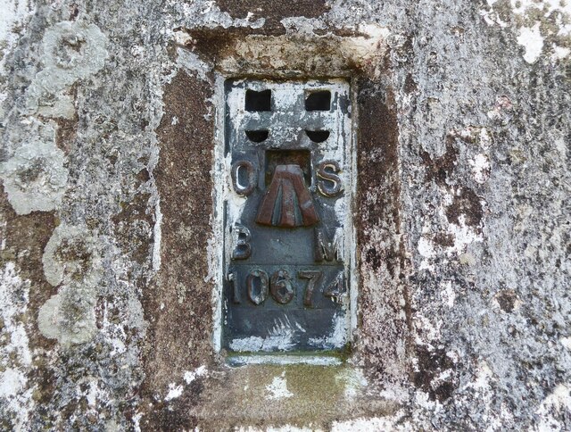
Flush Bracket benchmark, Powson Knott
Detail of the flush bracket benchmark on the Ordnance Survey triangulation pillar on the summit of Powson Knott. The flush bracket, benchmark number 10674, is on the west north west face of the pillar and marks a height of 412.699m above sea level (Ordnance Datum Newlyn), last levelled in 1961 (location photograph NY6409 : Triangulation pillar, Powson Knott).
Ordnance Survey Trig Point
A triangulation station, also known as a triangulation pillar, trigonometrical station, trigonometrical point, trig station, trig beacon or trig point. Erected by the Ordnance Survey.
See Linkfor more details about Trig Stations.
 Map © Crown Copyright")
TIP: Click the map for more Large scale mapping
- Grid Square
- NY6409, 32 images (more nearby 🔍)
- Photographer
- Adrian Taylor (more nearby)
- Date Taken
- Wednesday, 19 January, 2022 (more nearby)
- Submitted
- Wednesday, 19 January, 2022
- Subject Location
-
OSGB36:
 NY 64697 09226 [1m precision]
WGS84: 54:28.6292N 2:32.7789W - Camera Location
-
OSGB36: NY 64697 09226
- View Direction
- East-southeast (about 112 degrees)