2008
SE9946 : Hall Garth & St Mary's Lockington
taken 16 years ago, near to Lockington, East Riding of Yorkshire, England
This is 1 of 3 images, with title starting with Hall Garth in this square
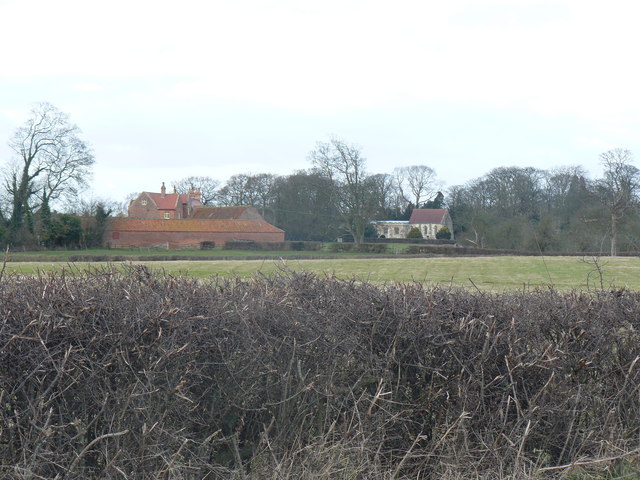
Hall Garth & St Mary's Lockington
Hall Garth is the name of the building on the left of the photo. It has the appearance of a local manor house. Significant earthworks are adjacent to it. The shape suggests that this was once the location of a significant local castle.
 Map © Crown Copyright")
TIP: Click the map for more Large scale mapping
- Grid Square
- SE9946, 62 images (more nearby 🔍)
- Photographer
- Neil Smith (more nearby)
- Date Taken
- Sunday, 2 March, 2008 (more nearby)
- Submitted
- Sunday, 2 March, 2008
- Subject Location
-
OSGB36:
 SE 998 465 [100m precision]
WGS84: 53:54.3412N 0:28.9255W - Camera Location
-
OSGB36: TA 000 464
- View Direction
- Northwest (about 315 degrees)