2005
ST4916 : The tower on St Michael's Hill, Montacute
taken 18 years ago, near to Montacute, Somerset, England
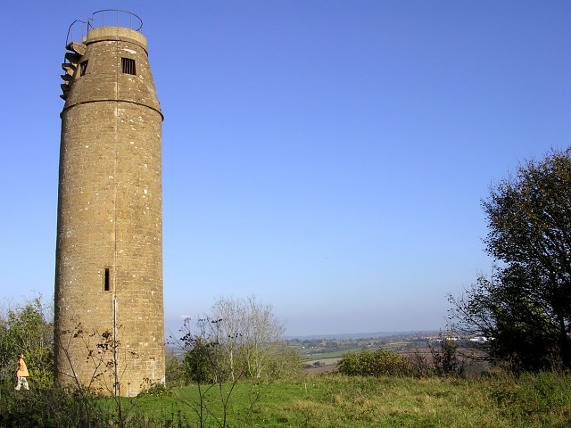
The tower on St Michael's Hill, Montacute
This 18th century lookout tower tops the conical hill that gives the village of Montacute its name (from the Latin "mons acutus", literally meaning "steep hill"). The tower was constructed as a folly by the Phelips family in 1760, and can clearly be seen from Montacute House in the village below. The greek inscription above the doorway to the tower describes it as a lookout, and there is a small fireplace and chimney at the top of the 52-step spiral staircase. There are stories that the tower is connected to Montacute House by a 'secret tunnel' but these have never been substantiated. The tower is privately owned, but open to the public, and there are views over the whole of south Somerset from the windows at the top.
 Map © Crown Copyright")
TIP: Click the map for more Large scale mapping
- Grid Square
- ST4916, 206 images (more nearby 🔍)
- Photographer
- Jim Champion (more nearby)
- Date Taken
- Thursday, 27 October, 2005 (more nearby)
- Submitted
- Thursday, 27 October, 2005
- Subject Location
-
OSGB36:
 ST 493 169 [100m precision]
WGS84: 50:56.9576N 2:43.3862W