2022
NY2800 : Path traversing northern side of Black Sails
taken 2 years ago, 4 km E of Cockley Beck, Cumbria, England
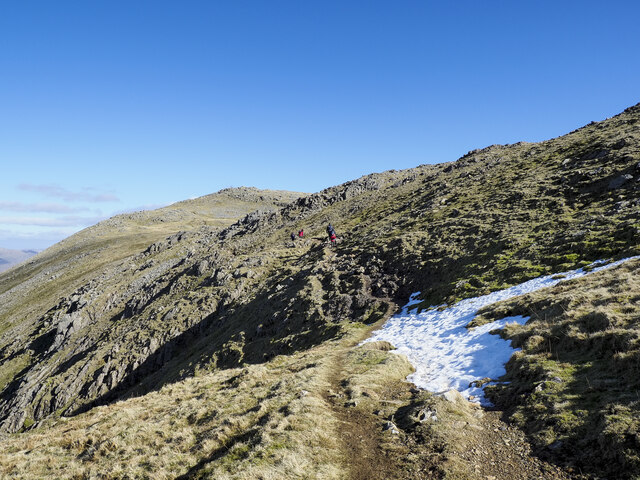
Path traversing northern side of Black Sails
Black Sails is a summit among the Coniston group of mountains; it rises to the right out of the image. Probably, not being a 'Wainwright' top, it's rather ignored by many walkers and so this path has developed bypassing the hill and connecting Wetherlam, which is the distant summit, with Swirl How, behind the camera location.
 Map © Crown Copyright")
TIP: Click the map for more Large scale mapping
- Grid Square
- NY2800, 29 images (more nearby 🔍)
- Photographer
- Trevor Littlewood (more nearby)
- Date Taken
- Sunday, 6 March, 2022 (more nearby)
- Submitted
- Saturday, 12 March, 2022
- Subject Location
-
OSGB36:
 NY 2832 0097 [10m precision]
WGS84: 54:23.9478N 3:6.3365W - Camera Location
-
OSGB36: NY 2824 0095
- View Direction
- East-northeast (about 67 degrees)