2022
SE1019 : Wapping Nick Lane crossing Harrow Clough
taken 2 years ago, near to Holywell Green, Calderdale, England
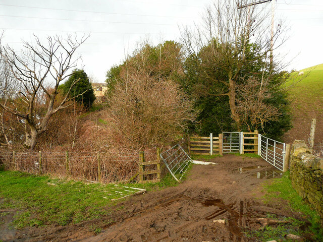
Wapping Nick Lane crossing Harrow Clough
The stream is the boundary between Old Lindley in Calderdale and Longwood in Kirklees. In Old Lindley the bridleway becomes a grassy track after the initial mud.
 Map © Crown Copyright")
TIP: Click the map for more Large scale mapping
- Grid Square
- SE1019, 84 images (more nearby 🔍)
- Photographer
- Humphrey Bolton (more nearby)
- Date Taken
- Thursday, 17 March, 2022 (more nearby)
- Submitted
- Saturday, 19 March, 2022
- Subject Location
-
OSGB36:
 SE 1016 1905 [10m precision]
WGS84: 53:40.0699N 1:50.8623W - Camera Location
-
OSGB36: SE 1016 1904
- View Direction
- Northeast (about 45 degrees)