2022
SJ9598 : Old Boundary Marker in Stamford Park, Tameside
taken 2 years ago, near to Stalybridge, Tameside, England
This is 1 of 3 images, with title Old Boundary Marker in Stamford Park, Tameside in this square
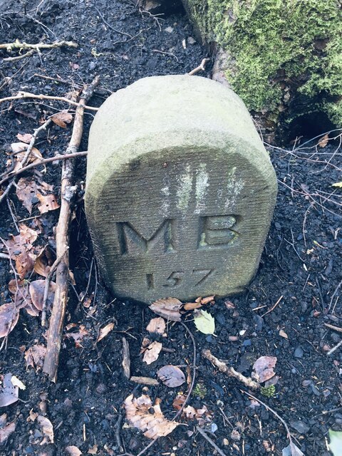
Old Boundary Marker in Stamford Park, Tameside
Municipal Boundary Marker on the west side of Stamford Park. On the former boundary of Stalybridge, Cheshire and Ashton-under-Lyne, Lancashire but now entirely in an unparished area of Tameside Metropolitan District. MB is assumed to indicate Municipal Borough.
Milestone Society National ID: CH_STAAUL157pb
Milestone Society National ID: CH_STAAUL157pb
National Survey of Wayside Features by The Milestone Society
These images are from Link
 Map © Crown Copyright")
TIP: Click the map for more Large scale mapping
- Grid Square
- SJ9598, 376 images (more nearby 🔍)
- Photographer
- D Garside (more nearby)
- Contributed by
- Mike Rayner (more nearby)
- Date Taken
- Friday, 25 February, 2022 (more nearby)
- Submitted
- Monday, 4 April, 2022
- Subject Location
-
OSGB36:
 SJ 95331 98991 [1m precision]
WGS84: 53:29.2566N 2:4.3100W - Camera Location
-
OSGB36: SJ 95331 98991