2004
NM4442 : Eas Fors
taken 20 years ago, near to Lagganulva, Isle of Mull, Argyll And Bute, Scotland
This is 1 of 20 images, with title Eas Fors in this square
Eas Fors
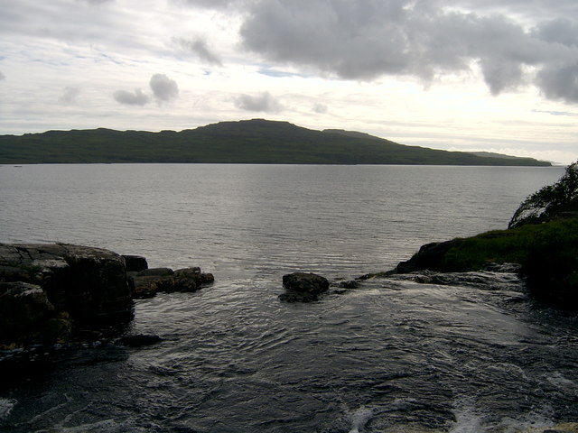
A bit of an optical illusion: the stream in the foreground appears to blend in with the sea, but in reality it plunges over the cliff edge to form Eas Fors. "Eas Fors" translates from Gaelic and Norse as "Waterfall, waterfall", so to call it "Eas Fors Waterfall" would be to really labour the point.
View across Loch Tuath to the island of Ulva.
View across Loch Tuath to the island of Ulva.
 Map © Crown Copyright")
TIP: Click the map for more Large scale mapping
- Grid Square
- NM4442, 73 images (more nearby 🔍)
- Photographer
- Callum Black (more nearby)
- Date Taken
- Tuesday, 15 June, 2004 (more nearby)
- Submitted
- Tuesday, 4 March, 2008
- Subject Location
-
OSGB36:
 NM 443 422 [100m precision]
WGS84: 56:30.1385N 6:9.3308W - Camera Location
-
OSGB36: NM 443 422
- View Direction
- Southwest (about 225 degrees)