2022
TF0306 : Old Boundary Marker on the B1443 Barnack Road in Stamford
taken 2 years ago, near to Stamford, Lincolnshire, England
This is 1 of 2 images, with title Old Boundary Marker on the B1443 Barnack Road in Stamford in this square
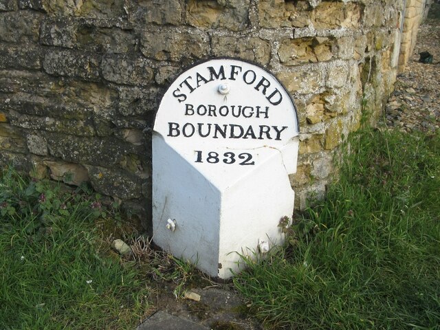
Old Boundary Marker on the B1443 Barnack Road in Stamford
Municipal Boundary Marker on the southeast side of the junction of the B1443 Barnack Road and Park Lane. On the boundary of Stamford, Lincolnshire and St Martins Without, See also Link.
Milestone Society National ID: LI_STASMW01pb
Milestone Society National ID: LI_STASMW01pb
National Survey of Wayside Features by The Milestone Society
These images are from Link
 Map © Crown Copyright")
TIP: Click the map for more Large scale mapping
- Grid Square
- TF0306, 720 images (more nearby 🔍)
- Photographer
- R Heywood (more nearby)
- Contributed by
- Mike Rayner (more nearby)
- Date Taken
- April 2022 (more nearby)
- Submitted
- Sunday, 10 April, 2022
- Subject Location
-
OSGB36:
 TF 03212 06754 [1m precision]
WGS84: 52:38.9226N 0:28.5505W - Camera Location
-
OSGB36: TF 03212 06754
- View Direction
- North-northeast (about 22 degrees)