2022
SE1673 : Old Boundary Marker on Carle Moor
taken 2 years ago, 3 km from Greygarth, North Yorkshire, England
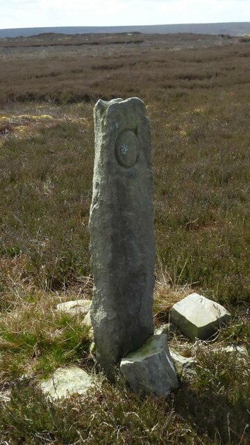
Old Boundary Marker on Carle Moor
Parish Boundary Marker on Carle Moor southeast of the shooting lodge. Inscribed G and L on opposite faces. Formerly on the boundary of Grewelthorpe and Laverton parishes but is now entirely in Laverton. See also Link.
Milestone Society National ID: YW_LAVE03pb
Milestone Society National ID: YW_LAVE03pb
National Survey of Wayside Features by The Milestone Society
These images are from Link
 Map © Crown Copyright")
TIP: Click the map for more Large scale mapping
- Grid Square
- SE1673, 11 images (more nearby 🔍)
- Photographer
- Mike Rayner (more nearby)
- Date Taken
- Sunday, 24 April, 2022 (more nearby)
- Submitted
- Monday, 25 April, 2022
- Subject Location
-
OSGB36:
 SE 16323 73786 [1m precision]
WGS84: 54:9.5777N 1:45.0917W - Camera Location
-
OSGB36: SE 16323 73786