SJ8414 : Shropshire Union Canal - Ryehill Bridge (No.22)
taken 2 years ago, near to Marston, Staffordshire, England
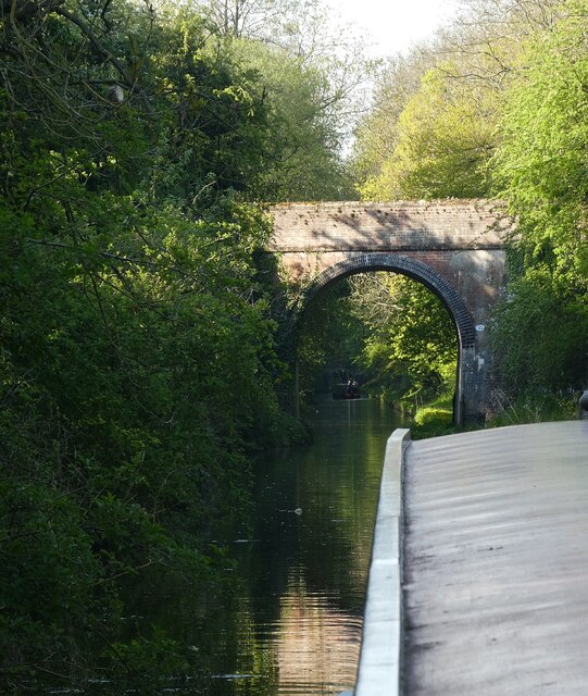
SJ8415 : Shropshire Union Canal - Ryehill Cutting Bridge (No.23) can be seen in the distance beyond the next narrowboat.
Unlike most of the bridges along the canal, this one is not listed as significant by English Heritage.
The Shropshire Union Canal (from Autherley to Nantwich) was engineered by Thomas Telford and opened in 1835. There are long straight sections of this canal which required either embankments or cuttings to avoid the need for locks. Although this was a more difficult procedure, the end route was shorter and the progress for horse drawn working boats could be maintained with (hopefully) no stoppages. The canal (formerly the Birmingham and Liverpool Junction Canal) was opened at a time when railways were making serious inroads into the canal companies' businesses.
The current Shroppie north of Nantwich was formerly the Chester Canal, opened in 1779, and has wider locks and bridges. Boats up to nine feet in beam can still navigate this section; Telford's canal accommodates only narrowboats up to seven feet in beam.
 Map © Crown Copyright")
- Grid Square
- SJ8414, 82 images (more nearby 🔍)
- Photographer
- Rob Farrow (more nearby)
- Date Taken
- Friday, 29 April, 2022 (more nearby)
- Submitted
- Tuesday, 3 May, 2022
- Subject Location
-
OSGB36:
 SJ 8470 1499 [10m precision]
WGS84: 52:43.9397N 2:13.6809W - Camera Location
-
OSGB36: SJ 8471 1495
- View Direction
- NORTH (about 0 degrees)