2022
SJ3112 : Shropshire viewed from Middletown Hill
taken 2 years ago, near to Wollaston, Shropshire, England
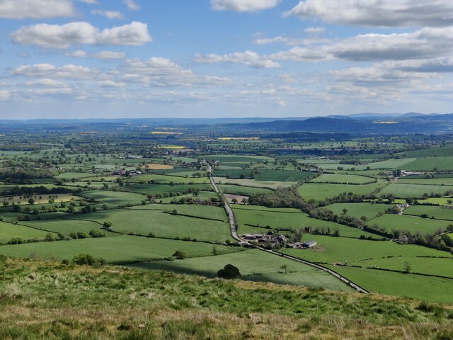
Shropshire viewed from Middletown Hill
Middletown Hill is part of the Breidden Hills, which are made up of Breidden Hill (365m 1,197ft), Moel y Golfa (meaning Bare or Bald Hill), the highest at (403m 1,322ft), Middletown Hill (367m 1,204ft), Kempsters Hill and Bausely Hill. They are on the border of England and Wales (Shropshire/Powys), about ten miles west of Shrewsbury.
Breidden Hill is an extinct volcano, and has Rodney's Pillar on its summit. Middletown Hill has an ancient Iron Age Hill fort on its summit.
Breidden Hill is an extinct volcano, and has Rodney's Pillar on its summit. Middletown Hill has an ancient Iron Age Hill fort on its summit.
 Map © Crown Copyright")
TIP: Click the map for more Large scale mapping
- Grid Square
- SJ3112, 14 images (more nearby 🔍)
- Photographer
- Mat Fascione (more nearby)
- Date Taken
- Saturday, 7 May, 2022 (more nearby)
- Submitted
- Thursday, 12 May, 2022
- Subject Location
-
OSGB36:
 SJ 315 126 [100m precision]
WGS84: 52:42.4359N 3:0.8371W - Camera Location
-
OSGB36: SJ 306 133
- View Direction
- Southeast (about 135 degrees)