2022
TQ0887 : Celandine Route map
taken 2 years ago, near to Ruislip, Hillingdon, England
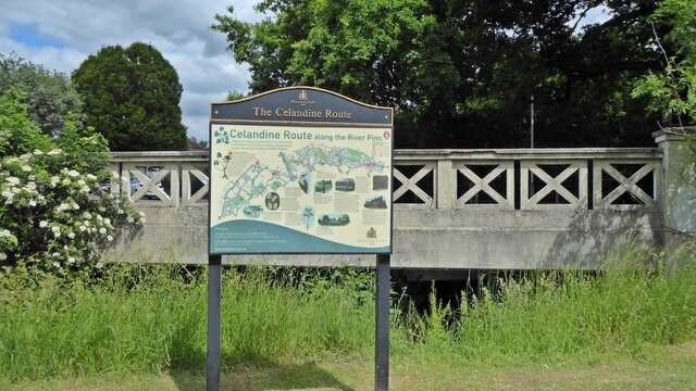
Celandine Route map
The Celandine Route is a 12-mile walk which follows the River Pinn from Pinner to the Grand Union Canal at Cowley. Hillingdon Council has provided maps and waymarking.
 Map © Crown Copyright")
TIP: Click the map for more Large scale mapping
- Grid Square
- TQ0887, 40 images (more nearby 🔍)
- Photographer
- Mark Percy (more nearby)
- Date Taken
- Saturday, 28 May, 2022 (more nearby)
- Submitted
- Monday, 6 June, 2022
- Subject Location
-
OSGB36:
 TQ 08919 87959 [1m precision]
WGS84: 51:34.7987N 0:25.7696W - Camera Location
-
OSGB36: TQ 08919 87959
- View Direction
- NORTH (about 0 degrees)