2022
HY4711 : Chapel footings, Bay of Meil, Orkney
taken 2 years ago, near to Berstane, Mainland, Orkney Islands, Scotland
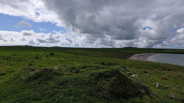
Chapel footings, Bay of Meil, Orkney
In 'The Ecclesiastical Architecture of Scotland from the Earliest Christian Times to the Seventeenth Century' (D MacGibbon and T Ross, 1896) the chapel is described as 'situated within a few yards of the shore, and not many feet above water level. It is only a heap of ruins, but the measures are just ascertainable. It is a parallelogram, measuring 37 feet east and west by 15 feet 4 inches north and south inside. The north and south walls are 2 feet 6 inches thick, and east and west ends 3 feet 3 inches, and are of the red sandstone of the locality. There was a door in the south wall.'
 Map © Crown Copyright")
TIP: Click the map for more Large scale mapping
- Grid Square
- HY4711, 2 images (more nearby 🔍)
- Photographer
- Claire Pegrum (more nearby)
- Date Taken
- Tuesday, 24 May, 2022 (more nearby)
- Submitted
- Thursday, 9 June, 2022
- Subject Location
-
OSGB36:
 HY 47959 11703 [1m precision]
WGS84: 58:59.3564N 2:54.4354W - Camera Location
-
OSGB36: HY 47959 11703
- View Direction
- West-northwest (about 292 degrees)