2017
SO8582 : Whittington Lock south-east of Kinver, Staffordshire
taken 7 years ago, near to Whittington, Staffordshire, England
This is 1 of 2 images, with title Whittington Lock south-east of Kinver, Staffordshire in this square
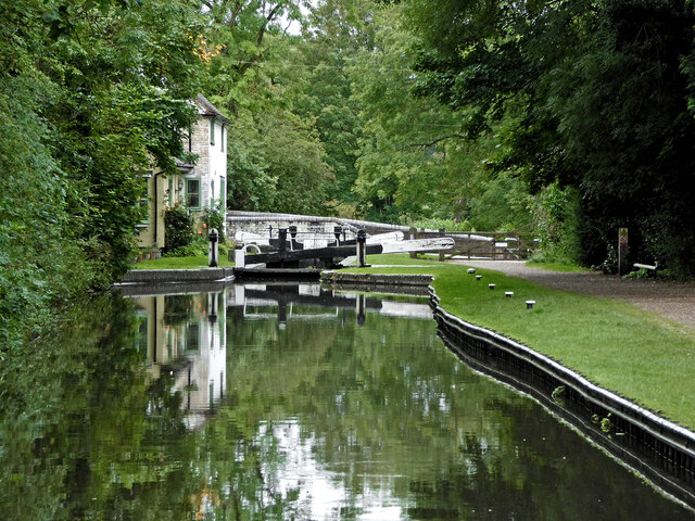
Whittington Lock south-east of Kinver, Staffordshire
A telephoto assisted image; Whittington Lock on the Staffordshire and Worcestershire Canal provides a fall (or rise) of 9ft 9in (just under three metres).
Whittington Bridge carries the narrow lane (Windsor Holloway) linking Cookley Lane with the A449 Kidderminster Road.
Whittington Bridge carries the narrow lane (Windsor Holloway) linking Cookley Lane with the A449 Kidderminster Road.
 Map © Crown Copyright")
TIP: Click the map for more Large scale mapping
- Grid Square
- SO8582, 143 images (more nearby 🔍)
- Photographer
- Roger D Kidd (more nearby)
- Date Taken
- Monday, 21 August, 2017 (more nearby)
- Submitted
- Sunday, 19 June, 2022
- Subject Location
-
OSGB36:
 SO 8531 8250 [10m precision]
WGS84: 52:26.4161N 2:13.0518W - Camera Location
-
OSGB36: SO 8532 8255
- View Direction
- South-southwest (about 202 degrees)