2022
NH5529 : Loch Ness Eastern Shore near Whitefield
taken 2 years ago, near to Whitefield, Highland, Scotland
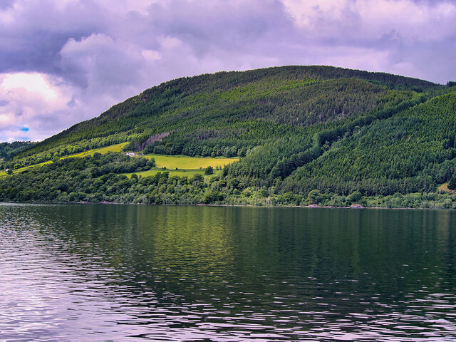
Loch Ness Eastern Shore near Whitefield
Loch Ness is a large, deep, freshwater loch in the Scottish Highlands extending for approximately 23 miles along what is called Glen Mor, or The Great Glen, a 60-mile fissure which was gouged out by glaciers during the last ice age and runs from Inverness in the north to Fort William in the south.
The Loch itself is the second largest Scottish loch by surface area at 22 square miles but is the largest by volume in the British Isles due to its great depth; it is over 700 feet deep, and the nearby surrounding hills rise by about the same amount. Its water visibility is exceptionally low due to a high peat content in the surrounding soil.
The Loch itself is the second largest Scottish loch by surface area at 22 square miles but is the largest by volume in the British Isles due to its great depth; it is over 700 feet deep, and the nearby surrounding hills rise by about the same amount. Its water visibility is exceptionally low due to a high peat content in the surrounding soil.
 Map © Crown Copyright")
TIP: Click the map for more Large scale mapping
- Grid Square
- NH5529, 13 images (more nearby 🔍)
- Photographer
- David Dixon (more nearby)
- Date Taken
- Tuesday, 21 June, 2022 (more nearby)
- Submitted
- Tuesday, 28 June, 2022
- Subject Location
-
OSGB36:
 NH 557 293 [100m precision]
WGS84: 57:19.8796N 4:23.9159W - Camera Location
-
OSGB36: NH 552 295
- View Direction
- East-southeast (about 112 degrees)