2022
SD6970 : Old Boundary Marker between Ingleton and High Bentham
taken 2 years ago, 3 km from Ingleton, North Yorkshire, England
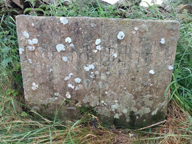
Old Boundary Marker between Ingleton and High Bentham
Parish Boundary Marker on the east side of Nutgill Lane southeast of the turn to Nutgill Farm. On the boundary of Ingleton and Bentham parishes. Inscribed INGLETON (vertical line) BENTHAM. See also Link.
Milestone Society National ID: YW_INGBEN01pb
Milestone Society National ID: YW_INGBEN01pb
National Survey of Wayside Features by The Milestone Society
These images are from Link
 Map © Crown Copyright")
TIP: Click the map for more Large scale mapping
- Grid Square
- SD6970, 10 images (more nearby 🔍)
- Photographer
- H Jones (more nearby)
- Contributed by
- Milestone Society (more nearby)
- Date Taken
- June 2022 (more nearby)
- Submitted
- Thursday, 30 June, 2022
- Subject Location
-
OSGB36:
 SD 69344 70296 [1m precision]
WGS84: 54:7.6558N 2:28.2357W - Camera Location
-
OSGB36: SD 69344 70296
- View Direction
- East-southeast (about 112 degrees)