2022
NO7356 : The 'High Red' navigation beacon near Scurdie Ness
taken 2 years ago, near to Ferryden, Angus, Scotland
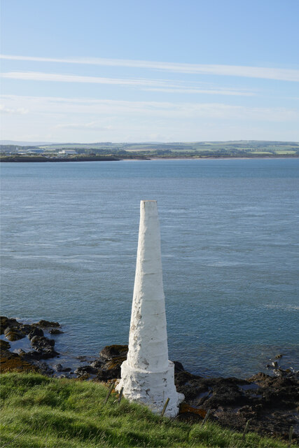
The 'High Red' navigation beacon near Scurdie Ness
One of two navigation beacons west of the lighthouse at Scurdie Ness.
This photograph was taken during the Coronavirus (COVID-19) pandemic of 2020/21/22.
This photograph was taken during the Coronavirus (COVID-19) pandemic of 2020/21/22.
 Map © Crown Copyright")
TIP: Click the map for more Large scale mapping
- Grid Square
- NO7356, 129 images (more nearby 🔍)
- Photographer
- James T M Towill (more nearby)
- Date Taken
- Friday, 17 June, 2022 (more nearby)
- Submitted
- Thursday, 7 July, 2022
- Subject Location
-
OSGB36:
 NO 7302 5680 [10m precision]
WGS84: 56:42.1276N 2:26.5331W - Camera Location
-
OSGB36: NO 7303 5678
- View Direction
- NORTH (about 0 degrees)