2022
SD6055 : Gables Plantation
taken 2 years ago, near to Tarnbrook, Lancashire, England
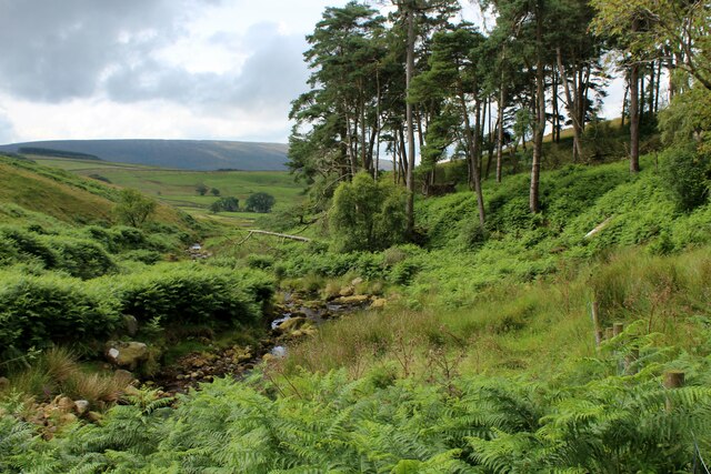
Gables Plantation
Small square of woodland above the Tarnbrook Wyre - the area smothered in head high bracken
 Map © Crown Copyright")
TIP: Click the map for more Large scale mapping
- Grid Square
- SD6055, 5 images (more nearby 🔍)
- Photographer
- Chris Heaton (more nearby)
- Date Taken
- Wednesday, 27 July, 2022 (more nearby)
- Submitted
- Sunday, 31 July, 2022
- Subject Location
-
OSGB36:
 SD 6000 5597 [10m precision]
WGS84: 53:59.8923N 2:36.7005W - Camera Location
-
OSGB36: SD 6003 5599
- View Direction
- West-southwest (about 247 degrees)