2021

SO7447 : Sabrina Way

taken 3 years ago, near to Cradley, County of Herefordshire, England

This is 1 of 2 images, with title Sabrina Way in this square
Sabrina Way
Sabrina Way
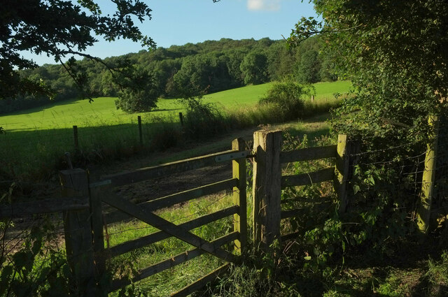
Following Cradley bridleway CD43 across field boundaries and into a field below Whitman's Hill Coppice.

Creative Commons Licence [Some Rights Reserved]   © Copyright Derek Harper and licensed for reuse under this Creative Commons Licence.
Geographical Context: Lowlands Paths Farm, Fishery, Market Gardening Woodland, Forest Long Distance Bridleway: Sabrina Way Gate: Timber Fence: Timber Post and Wire other tags: Bridleway Grass Field Tree in Field Wood Click a tag, to view other nearby images.
This photo is linked from: Other Photos: · Footpath towards Storridge · Sabrina Way approaching Whitman's Hill Coppice Title Clusters: · Sabrina Way [2] ·
1:50,000 Modern Day Landranger(TM) Map © Crown Copyright
+
+
1:50,000 Modern Day Landranger(TM) Map © Crown Copyright
TIP: Click the map for more Large scale mapping
Grid Square
SO7447, 79 images   (more nearby 🔍)
Photographer
Derek Harper   (more nearby)
Date Taken
Tuesday, 13 July, 2021   (more nearby)
Submitted
Thursday, 4 August, 2022
Subject Location
OSGB36: geotagged! SO 7470 4768 [10m precision]
WGS84: 52:7.6106N 2:22.2590W
Camera Location
OSGB36: geotagged! SO 7470 4766
View Direction
NORTH (about 0 degrees)
Clickable map
+
NW N NE
W Go E
SW S SE
Image Type (about): geograph 
This page has been viewed about 12 times
You are not logged in login | register