2021
TR1948 : Chalk dry valley
taken 3 years ago, near to Breach, Kent, England
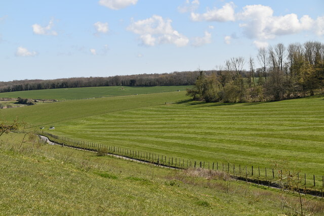
Chalk dry valley
Dry valleys are relict landforms left over from the ice age. During the ice age, ice plugged all the pore spaces in the chalk rendering it impermeable. During the summer months meltwater would carve a valley and create the feature. After the ice age the chalk became permeable and porous and all surface water was lost leaving an obvious water carved valley, but now dry.
They are common on the dip slopes of Chalk escarpments.
See other images of Dry Valley (Chalk)
They are common on the dip slopes of Chalk escarpments.
See other images of Dry Valley (Chalk)
 Map © Crown Copyright")
TIP: Click the map for more Large scale mapping
- Grid Square
- TR1948, 25 images (more nearby 🔍)
- Photographer
- N Chadwick (more nearby)
- Date Taken
- Friday, 16 April, 2021 (more nearby)
- Submitted
- Wednesday, 10 August, 2022
- Subject Location
-
OSGB36:
 TR 1933 4852 [10m precision]
WGS84: 51:11.6273N 1:8.2601E - Camera Location
-
OSGB36: TR 1911 4862
- View Direction
- East-southeast (about 112 degrees)