2008
NM8752 : The Kingairloch Road
taken 16 years ago, near to Camasnacroise, Highland, Scotland
This is 1 of 2 images, with title The Kingairloch Road in this square
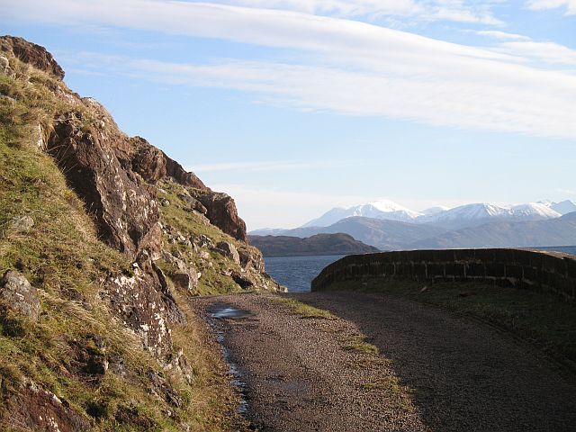
The Kingairloch Road
Narrow, rockfall strafed section of road beneath A' Mhaodalach. Ben Nevis in the background.
 Map © Crown Copyright")
TIP: Click the map for more Large scale mapping
- Grid Square
- NM8752, 20 images (more nearby 🔍)
- Photographer
- Richard Webb (more nearby)
- Date Taken
- Saturday, 15 March, 2008 (more nearby)
- Submitted
- Tuesday, 18 March, 2008
- Subject Location
-
OSGB36:
 NM 875 529 [100m precision]
WGS84: 56:37.1824N 5:27.9096W - Camera Location
-
OSGB36: NM 874 528
- View Direction
- Northeast (about 45 degrees)