2008
TQ3210 : Ditchling, Tanners pond
taken 16 years ago, near to Stanmer, Brighton And Hove, England
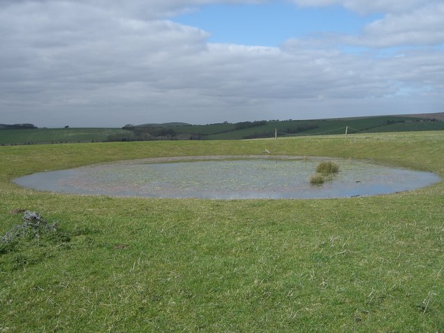
Ditchling, Tanners pond
One of two dewponds either side of the Ditchling road.
Lower Standean farm can be seen in the centre with Wolstonbury hill (Pyecombe) in the background.
Lower Standean farm can be seen in the centre with Wolstonbury hill (Pyecombe) in the background.
 Map © Crown Copyright")
TIP: Click the map for more Large scale mapping
- Grid Square
- TQ3210, 69 images (more nearby 🔍)
- Photographer
- Peter Cox (more nearby)
- Date Taken
- Monday, 17 March, 2008 (more nearby)
- Submitted
- Tuesday, 18 March, 2008
- Subject Location
-
OSGB36:
 TQ 3218 1083 [10m precision]
WGS84: 50:52.9111N 0:7.3442W - Camera Location
-
OSGB36: TQ 3218 1083
- View Direction
- Northwest (about 315 degrees)