2008
NM8757 : Summit area, Creach Bheinn
taken 16 years ago, 3 km from Kilmalieu, Highland, Scotland
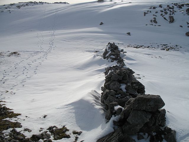
Summit area, Creach Bheinn
A dip just north of the summit. The dyke was built to protect the camp. The camp on Creach Bheinn has been atributed to a watch point from the Napoleonic Wars. Creach Bheinn is a very fine viewpoint. These qualities made the hill attractive to the Ordnance Survey who used it as primary trigonometric site.
The camp probably dates to the survey of Thomas Colby in the mid 19th century.
The camp probably dates to the survey of Thomas Colby in the mid 19th century.
 Map © Crown Copyright")
TIP: Click the map for more Large scale mapping
- Grid Square
- NM8757, 13 images (more nearby 🔍)
- Photographer
- Richard Webb (more nearby)
- Date Taken
- Saturday, 15 March, 2008 (more nearby)
- Submitted
- Thursday, 20 March, 2008
- Subject Location
-
OSGB36:
 NM 871 577 [100m precision]
WGS84: 56:39.7487N 5:28.5371W - Camera Location
-
OSGB36: NM 871 577
- View Direction
- South-southwest (about 202 degrees)