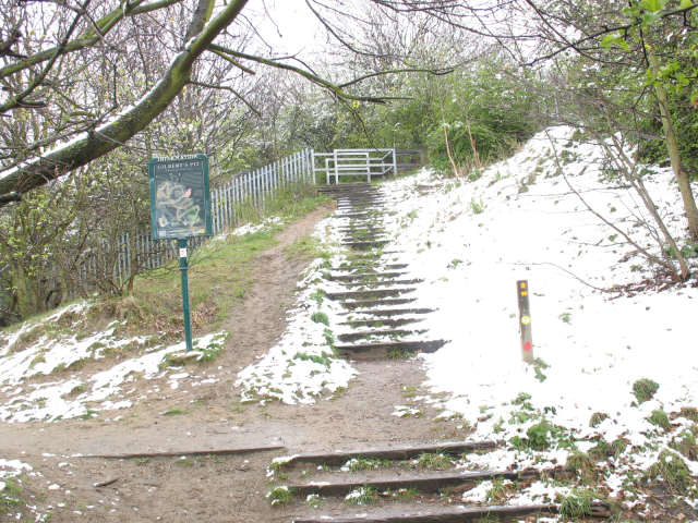
TQ4178 : Steps to Gilbert's Pit
taken 16 years ago, near to Charlton, Greenwich, England
The Green Chain Walk is a network of paths in south-east London that connects locations including the Thames Barrier, Thamesmead and Erith along the river, and at the other end Crystal Palace and Chislehurst.
The route was created in 1977 by a joint team of four London boroughs. What makes it distinctive is the way it connects parks and other open spaces as far as possible, including fragments of ancient woodland at Oxleas and Lesnes Abbey Woods, heathland at Plumstead Common and large parks such as Avery Hill and Crystal Palace. The longest continuous route is Thamesmead to Crystal Palace (26.5km), with many links making up the total of 64km.
The official website is Link
The pit is a disused sand quarry, worked from Roman times until the early 20th century for its high quality fine sand used in glassmaking. It is now a SSSI (Site of Special Scientific Interest) because the exposed quarry face in the distance (before it became overgrown with trees) yielded a 'textbook example' of a geological sequence of chalk, sands and gravels from 70-55 million years ago, with several fossil finds including sharks and crocodiles.
 Map © Crown Copyright")
- Grid Square
- TQ4178, 285 images (more nearby 🔍)
- Photographer
- Stephen Craven (more nearby)
- Date Taken
- Sunday, 6 April, 2008 (more nearby)
- Submitted
- Sunday, 6 April, 2008
- Subject Location
-
OSGB36:
 TQ 417 786 [100m precision]
WGS84: 51:29.3581N 0:2.4352E - Camera Location
-
OSGB36: TQ 417 786
- View Direction
- Northeast (about 45 degrees)