2008
NG4720 : Path on the south side of Loch Coruisk
taken 16 years ago, near to Meall na Cuilce [hill or Mountain], Highland, Great Britain
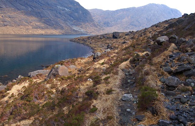
Path on the south side of Loch Coruisk
This is one of the well defined sections of path around the loch. In many places it becomes lost amongst bog and boilerplate rock. Sgurr na Stri in the background.
 Map © Crown Copyright")
TIP: Click the map for more Large scale mapping
- Grid Square
- NG4720, 18 images (more nearby 🔍)
- Photographer
- John Allan (more nearby)
- Date Taken
- Saturday, 12 April, 2008 (more nearby)
- Submitted
- Sunday, 13 April, 2008
- Subject Location
-
OSGB36:
 NG 477 208 [100m precision]
WGS84: 57:12.5128N 6:10.7504W - Camera Location
-
OSGB36: NG 476 208
- View Direction
- East-southeast (about 112 degrees)