2008
SD7537 : Jeppe Knave Grave
taken 16 years ago, near to Wiswell, Lancashire, England
This is 1 of 2 images, with title starting with Jeppe Knave in this square
Jeppe Knave Grave
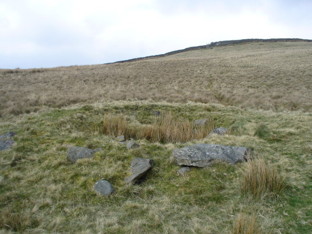
The words Jeppe Knave Grave on the OS map relate to this circular grass-covered mound about 15 m in diameter with a stone filled depression in the centre measuring 5 x 3 m.
This is thought to be a mutilated Bronze Age burial mound which would have originally contained the body of a local chieftain.
However local legend refers to a man Jeppe outlawed for breaking forest laws during early Norman times.
Whitaker in His History of Whalley (1818) said The name occurs in a record of the boundaries between Wiswell and Pendleton dated 1342, and is there said to be derived from a robber who was beheaded and was buried at that point because the neighbouring vills refused to have him buried within them.
 Map © Crown Copyright")
TIP: Click the map for more Large scale mapping
- Grid Square
- SD7537, 24 images (more nearby 🔍)
- Photographer
- Peter Worrell (more nearby)
- Date Taken
- Wednesday, 16 April, 2008 (more nearby)
- Submitted
- Wednesday, 16 April, 2008
- Subject Location
-
OSGB36:
 SD 759 378 [100m precision]
WGS84: 53:50.1735N 2:21.9980W - Camera Location
-
OSGB36: SD 759 378
- View Direction
- Northeast (about 45 degrees)