2008
NU2410 : The Aln Estuary
taken 16 years ago, near to Alnmouth, Northumberland, England
This is 1 of 6 images, with title The Aln Estuary in this square
The Aln Estuary
NU2410 : The Aln Estuary : previous (image 6 of 8 ) next : NU2410 : The Aln Estuary
(A short walk along the B1338 between Hipsburn and Alnmouth)
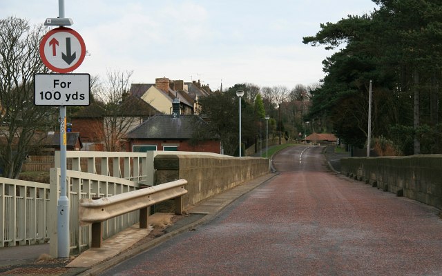
The photograph is of a road-bridge carrying the B1338 across the River Aln into the western side of Alnmouth. To the left can be seen a pedestrian walkway built alongside the bridge.
(A short walk along the B1338 between Hipsburn and Alnmouth)
The photograph is of a road-bridge carrying the B1338 across the River Aln into the western side of Alnmouth. To the left can be seen a pedestrian walkway built alongside the bridge.
 Map © Crown Copyright")
TIP: Click the map for more Large scale mapping
- Grid Square
- NU2410, 438 images (more nearby 🔍)
- Photographer
- Alan Walker (more nearby)
- Date Taken
- Saturday, 2 February, 2008 (more nearby)
- Submitted
- Wednesday, 14 May, 2008
- Subject Location
-
OSGB36:
 NU 243 108 [100m precision]
WGS84: 55:23.4444N 1:37.0391W - Camera Location
-
OSGB36: NU 242 108
- View Direction
- EAST (about 90 degrees)