2008
SS8385 : Track junction at the south west corner of Coed Cwm Kenfig
taken 16 years ago, 3 km from Kenfig Hill, Bridgend/Pen-y-Bont ar Ogwr, Wales
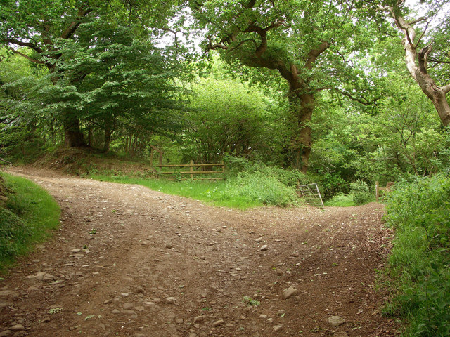
Track junction at the south west corner of Coed Cwm Kenfig
A junction of tracks, both also footpaths, in a pleasant deciduous area on the edge of the large and often coniferous wood Coed Cwm Kenfig. The more easterly track, to the right, takes one into the heart of this wood, a southern portion of which occupies a substantial part of the north of the grid square.
 Map © Crown Copyright")
TIP: Click the map for more Large scale mapping
- Grid Square
- SS8385, 9 images (more nearby 🔍)
- Photographer
- eswales (more nearby)
- Date Taken
- Sunday, 25 May, 2008 (more nearby)
- Submitted
- Tuesday, 27 May, 2008
- Subject Location
-
OSGB36:
 SS 835 855 [100m precision]
WGS84: 51:33.4015N 3:40.8418W - Camera Location
-
OSGB36: SS 835 855
- View Direction
- East-northeast (about 67 degrees)