2008
NN5355 : Allt Camghouran
taken 16 years ago, near to Camghouran, Perth And Kinross, Scotland
This is 1 of 4 images, with title Allt Camghouran in this square
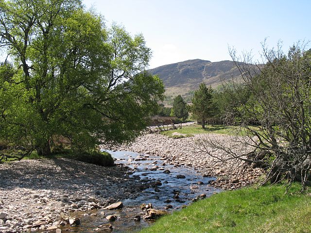
Allt Camghouran
A warm Summer day and the burn is low after a month of high pressure and low rainfall. Leagag in the background. This part of Coille Mhòr is open to grazing and is farmed with sheep grazing here.
 Map © Crown Copyright")
TIP: Click the map for more Large scale mapping
- Grid Square
- NN5355, 22 images (more nearby 🔍)
- Photographer
- Richard Webb (more nearby)
- Date Taken
- Sunday, 25 May, 2008 (more nearby)
- Submitted
- Monday, 2 June, 2008
- Subject Location
-
OSGB36:
 NN 538 551 [100m precision]
WGS84: 56:39.8918N 4:23.1662W - Camera Location
-
OSGB36: NN 539 552
- View Direction
- Southwest (about 225 degrees)