2008
TQ3104 : Brighton: Upper Rock Gardens
taken 16 years ago, near to Kemp Town, Brighton And Hove, England
This is 1 of 143 images, with title starting with Brighton in this square
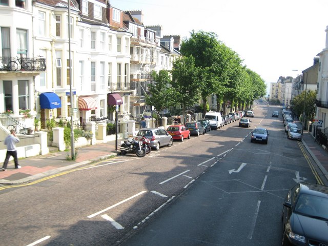
Brighton: Upper Rock Gardens
Please see Simon's TQ3104 : Upper Rock Gardens from his excellent centisquare walkabout of TQ3104 for the history of the development of this street. St Mary's Church is on the left but behind the trees, and the sea can just be glimpsed at the bottom of Lower Rock Gardens in the distance.
 Map © Crown Copyright")
TIP: Click the map for more Large scale mapping
- Grid Square
- TQ3104, 2031 images (more nearby 🔍)
- Photographer
- Nigel Cox (more nearby)
- Date Taken
- Sunday, 8 June, 2008 (more nearby)
- Submitted
- Saturday, 14 June, 2008
- Subject Location
-
OSGB36:
 TQ 318 040 [100m precision]
WGS84: 50:49.2332N 0:7.8155W - Camera Location
-
OSGB36: TQ 318 041
- View Direction
- SOUTH (about 180 degrees)