1979
SD3035 : Slipway from Blackpool's promenade to the beach
taken 45 years ago, near to Blackpool, England
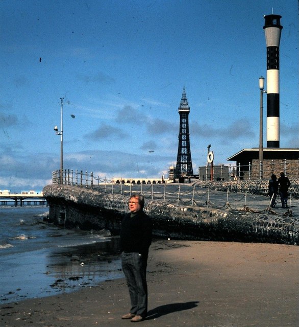
Slipway from Blackpool's promenade to the beach
Everyone will recognise Blackpool Tower and North Pier in the background, but what is the black and white tower in the foreground? It occurs in a number of later photos, but is never mentioned or named. A larger diameter black ring has been added since 1979, at the base of the inverted cone near its top. Is there perhaps a clue in the large blue 'V' that appears near the Central Pier on some OS maps?
 Map © Crown Copyright")
TIP: Click the map for more Large scale mapping
- Grid Square
- SD3035, 586 images (more nearby 🔍)
- Photographer
- Stanley Howe (more nearby)
- Date Taken
- April 1979 (more nearby)
- Submitted
- Tuesday, 24 June, 2008
- Subject Location
-
OSGB36:
 SD 305 350 [100m precision]
WGS84: 53:48.4250N 3:3.3844W - Camera Location
-
OSGB36: SD 305 350
- View Direction
- NORTH (about 0 degrees)