2008
NJ9604 : Nigg Bay
taken 16 years ago, near to Torry, Aberdeen, Scotland
This is 1 of 9 images, with title Nigg Bay in this square
Nigg Bay
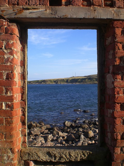
Looking out across Nigg Bay from a ruined building (old fishing hut?). A tranquil setting away from the throng round at the main beach.
Nigg Bay is the site where the Dee flowed into the sea until deposits from melting ice during the last ice age blocked the passage, leaving the bay we see today.
Nigg Bay is the site where the Dee flowed into the sea until deposits from melting ice during the last ice age blocked the passage, leaving the bay we see today.
 Map © Crown Copyright")
TIP: Click the map for more Large scale mapping
- Grid Square
- NJ9604, 69 images (more nearby 🔍)
- Photographer
- Lyn Anderson (more nearby)
- Date Taken
- Wednesday, 23 July, 2008 (more nearby)
- Submitted
- Saturday, 26 July, 2008
- Subject Location
-
OSGB36:
 NJ 968 043 [100m precision]
WGS84: 57:7.8250N 2:3.2201W - Camera Location
-
OSGB36: NJ 968 050
- View Direction
- SOUTH (about 180 degrees)