2008
NS2885 : Footpath to Tom na h-Airidh
taken 16 years ago, near to Rhu, Argyll And Bute, Scotland
This is 1 of 2 images, with title Footpath to Tom na h-Airidh in this square
Footpath to Tom na h-Airidh
Further downhill, the path to the summit of Tom na h-Airidh passes through a gap in a dry-stone wall: NS2885 : Footpath to Tom na h-Airidh.
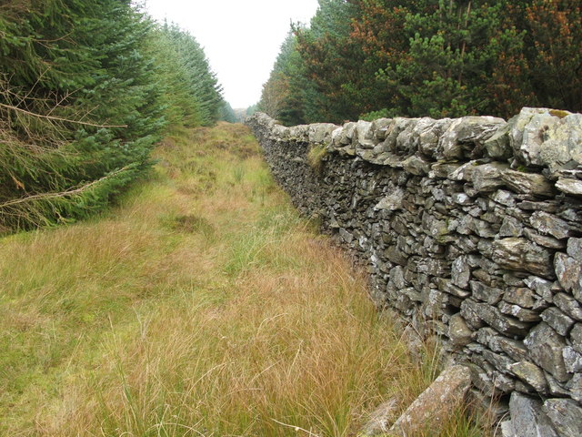
About 500 metres on, at the point shown in this photo, the footpath passes through a gap in a different stone wall, and it would be natural to carry on straight ahead; however, to reach the hilltop, it is necessary to turn right, leaving that path, and walk uphill, following the line of the wall (there is a lane free of trees on either side). The photograph shows this part of the uphill walk.
It is also necessary to cross to the other side of the stone wall at some point on the uphill journey, since the hill is on the other side; this presents no difficulty, since there are several gaps in the wall.
For another photograph taken at the same spot, but looking in the opposite direction, see: Link
 Map © Crown Copyright")
TIP: Click the map for more Large scale mapping
- Grid Square
- NS2885, 22 images (more nearby 🔍)
- Photographer
- Lairich Rig (more nearby)
- Date Taken
- Friday, 26 September, 2008 (more nearby)
- Submitted
- Saturday, 27 September, 2008
- Subject Location
-
OSGB36:
 NS 2832 8546 [10m precision]
WGS84: 56:1.8705N 4:45.4091W - Camera Location
-
OSGB36: NS 2831 8543
- View Direction
- North-northeast (about 22 degrees)