2008
TQ2711 : West Hill
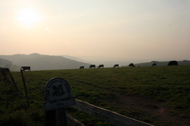
taken 16 years ago, near to Poynings, West Sussex, England
This is 1 of 3 images, with title West Hill in this square
West Hill
Called West Hill on the map, but the National Trust sign says New Timber Hill. Plenty of cows grazing the fields in this area.
 Map © Crown Copyright")
TIP: Click the map for more Large scale mapping
- Grid Square
- TQ2711, 108 images (more nearby 🔍)
- Photographer
- Barry Hunter (more nearby)
- Date Taken
- Sunday, 28 September, 2008 (more nearby)
- Submitted
- Sunday, 28 September, 2008
- Subject Location
-
OSGB36:
 TQ 278 116 [100m precision]
WGS84: 50:53.4167N 0:10.9923W - Camera Location
-
OSGB36: TQ 279 116
- View Direction
- West-northwest (about 292 degrees)