1981
SE9621 : Read's Island
taken 43 years ago, near to Ferriby Sluice, North Lincolnshire, England
This is 1 of 3 images, with title Read's Island in this square
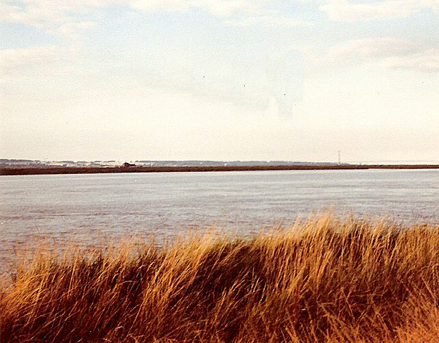
Read's Island
Looking across the South Humber Channel from West of Ferriby to the low Read's Island with the Humber Bridge in the distance.
 Map © Crown Copyright")
TIP: Click the map for more Large scale mapping
- Grid Square
- SE9621, 40 images (more nearby 🔍)
- Photographer
- Gerald England (more nearby)
- Date Taken
- 1981 (more nearby)
- Submitted
- Sunday, 5 October, 2008
- Subject Location
-
OSGB36:
 SE 966 216 [100m precision]
WGS84: 53:40.9270N 0:32.3248W - Camera Location
-
OSGB36: SE 960 212
- View Direction
- East-northeast (about 67 degrees)