Geograph - photograph every grid square
More:
Over Time
·
Recent
·
Tagged
·
Map
·
Browser
·
Others
Images of:
showing 58 of About
2,574
results. Explore these images more:
in the Browser
or
in the standard search
(may return slightly different results).
· Too many imprecise results? Try
Images
tagged
with [Saxmundham]
or
Pure Keyword Match for 'Saxmundham'
☰
Fersiwn Cymraeg
Home
View
Search
Marked Images
Maps
Browser
Explore
Showcase
New Images
Collections
Interact
Games
Discussions
Blog
Contributors
Submit
Statistics
Leaderboards
General
FAQ
Help Pages
Sitemap
Contact Us
Support Us
sponsored by
🔍
What to search:
Photos
Enter keywords or a location/postcode to search nearby images
Enter a Grid Reference
Placenames
Collections
Website Pages
Everything
Others:
Advanced Search
|
Image Browser
Or:
Coverage Map
|
Searchable Map
You are not logged in
login
|
register
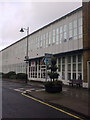
![TM3863 : Saxmundham buildings [13] by Michael Dibb](https://s2.geograph.org.uk/geophotos/06/72/87/6728734_bb343920_120x120.jpg)