More: Over Time · Recent · Map · Browser · Others
Images of:

TQ1527 : West along Southwater Street Southwater by Dave Spicer
TQ1528 : Demolition of Kirby's by The Saunterer
TQ1727 : Straw bales, Coltstaple Farm near Horsham by nick macneill
TQ1528 : Stile over fence by The Saunterer
TQ1527 : Footpath across a ploughed field, west of Worthing Rd by N Chadwick
TQ1627 : Coltstaple Lane by N Chadwick
TQ1627 : Blakes Farm House, Southwater St by N Chadwick
TQ1627 : Footpath junction on Jackrells Lane by Shazz
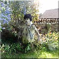
TQ1727 : Fred Flintstone - as a straw man by Ian Cunliffe
TQ1528 : East Lodge and gate to Christ's Hospital School by Dave Spicer
TQ1527 : Bend on bridleway at Two Mile Ash by Shazz
TQ1627 : Coltstaple Lane looking west from Pedlar's Lane by Shazz
TQ1528 : Fingerpost along Public Footpath FP1628/3 by The Saunterer
TQ1627 : Blakes Farm Rd looking south from Southwater St Bridge by N Chadwick
TQ1627 : Rear view of RSPCA building at Southwater by Dave Spicer
TQ1727 : Disused entrance to Sedgewick Park by Dave Spicer
TQ1727 : Aeroplane at Jackrells Farm Airfield by Ian Cunliffe
TQ1627 : Southwater Street by Simon Carey
TQ1727 : Footpath goes north from stile by Shazz
TQ1527 : Footpath along the edge of Smith Copse by N Chadwick
TQ1727 : House to the south of Coltstaple Lane by Ian Cunliffe
TQ1627 : Footpath reaches Jackrells Lane from the east by Shazz
TQ1627 : Business premises on Oakhurst Business Park by Dave Spicer
TQ1627 : Old Direction Sign - Signpost by Colstaple Lane, Southwater parish by Milestone Society
TQ1528 : The Old Lodge near Christ's Hospital by Dave Spicer
TQ1627 : Footpath FP1676 by The Saunterer
TQ1528 : An entrance to Christ's Hospital by The Saunterer
TQ1627 : Road Junction by The Saunterer
TQ1527 : Two Mile Ash Lane looking south by N Chadwick
TQ1727 : Rear of house on Coltstaple Lane by Ian Cunliffe
TQ1727 : Broadwater Lane by N Chadwick
TQ1627 : Roundabout at entrance to Business Park by Dave Spicer
TQ1727 : Little Coltstaple Farm by Chris Thomas-Atkin
TQ1627 : Cottages, Southwater St by N Chadwick
TQ1627 : Byway off Coltstaple Lane by N Chadwick
TQ1727 : Path alteration near Parson's Farm by Dave Spicer
TQ1527 : View north along Two Mile Ash Road towards Southwater by Dave Spicer
TQ1527 : Bridleway to Southwater by Dave Spicer
TQ1627 : Worthing Road by Chris Thomas-Atkin
TQ1627 : House at Blackwater Farm by Ian Cunliffe
TQ1527 : Sayers Farm by Dave Spicer
TQ1528 : Christ's Hospital, country road junction by Nigel Thompson
TQ1727 : Coltstaple Lane near Horsham by nick macneill
TQ1527 : Walkway off Southwater St by N Chadwick
TQ1727 : Looking southwards across field from footpath by Shazz
TQ1727 : Farmyard, possibly part of Coltstaple Farm or Parson's Farm by Dave Spicer
TQ1627 : Looking west from Jackrells Lane by Shazz
TQ1527 : Bridleway reaches Two Mile Ash Road by Shazz
TQ1727 : Cyclists on New Year's Day near Horsham by nick macneill
TQ1627 : Blakes Farm Road viewed from overhead bridge by Dave Spicer
TQ1627 : Entrance to Southwater Playing Fields, Coltstaple Lane by N Chadwick
TQ1727 : Coltstaple Lane, near Southwater by Simon Carey
TQ1527 : Worthing Road, Southwater by Simon Carey
TQ1528 : Field End by Dan Gregory
TQ1528 : East Lodge, Christ's Hospital by Simon Carey


showing 55 of About 175 results. Explore these images more: in the Browser or in the standard search (may return slightly different results).
You are not logged in login | register
showing 55 of About 175 results. Explore these images more: in the Browser or in the standard search (may return slightly different results).