More: Over Time · Recent · Tagged · Map · Browser · Others
Images of:

SK4960 : Skegby Hall by Alan Murray-Rust
SK4960 : Field footpath near Skegby Hall by Alan Murray-Rust
SK5158 : Newark Road (B6022) by JThomas
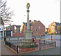
SK4959 : Sutton-in-Ashfield - War Memorial on Downing Street by Dave Bevis
SK4756 : Planted field above The Dumbles by Bill Boaden
SK4957 : Approaching Kings Mill Road East (A38) by John Topping
SK4860 : Stanton Hill - terraced housing on Co-operative Street by Dave Bevis
SK5060 : Skegby - The Rifle Volunteer on Forest Road by Dave Bevis
SK4760 : Public footpath west of Stanton Hill by Trevor Rickard
SK5058 : Robin Hood Line by John Topping
SK4858 : Memorial plaque by Jonathan Thacker
SK4960 : Church of St Andrew, Skegby by Graham Hogg
SK4860 : Stanton Hill - Ashfield Bike Breakers on High Street by Dave Bevis
SK5159 : Railway towards Mansfield by JThomas
SK5159 : Waterfowl on Kings Mill Dam by Alan Murray-Rust
SK4857 : Footbridge over the A38 by JThomas
SK4756 : Crowtrees Farm by Tom Courtney
SK4757 : Sutton-in-Ashfield - Duke of Sussex by Dave Bevis
SK4957 : Penny Emma Way B6021, Sutton in Ashfield by John Topping
SK4759 : Huthwaite - Victoria Club by Dave Bevis
SK4960 : The Skegby Trail by Alan Walker
SK4757 : Grange Farm by Tom Courtney
SK4756 : Dismantled Railway west of Franderground Farm by John Topping
SK4959 : Mini Market Polo, Mansfield Road, Sutton in Ashfield by Jonathan Thacker
SK5058 : Maun View Gardens, Sutton in Ashfield by John Topping
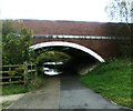
SK5159 : Subway under A617 by Alex McGregor
SK5058 : UK Give Way Sign by Gary
SK5058 : Footpath Level Crossing, Sutton in Ashfield by John Topping
SK4860 : The Brierley Branch Line by Alan Walker
SK4960 : Access to Hill Top Farm by Alex McGregor
SK4958 : Sutton-in-Ashfield - United Reformed Church by Dave Bevis
SK4756 : Grazing, The Dumbles by JThomas
SK4858 : The Mapplewells Inn by JThomas
SK4860 : Parking Area and Canine Centre at Brierley Industrial Park by Jonathan Clitheroe
SK4858 : Short terrace of houses by Alan Walker
SK4960 : Skegby Hall by Alan Murray-Rust
SK5059 : Travelodge Mansfield by Stephen McKay
SK5158 : Level Crossing, Coxmoor Road by Antony Dixon
SK4957 : A38/B6021 junction, Sutton in Ashfield by John Topping
SK4859 : Jubilee Road, Sutton in Ashfield by Richard Vince
SK4857 : A38 Kings Road, Sutton in Ashfield (4) by John Topping
SK4860 : Meden Bank by Trevor Rickard
SK4759 : Huthwaite - former CWS hosiery factory - N end of E block from N by Dave Bevis
SK4756 : The ford in The Dumbles by Antony Dixon
SK5060 : Large house, Skegby by JThomas
SK4959 : Playing fields off Stoneyford Road by JThomas
SK4859 : Community of Christ church, Carsic Estate by Nikki Mahadevan
SK4858 : Sutton-in-Ashfield - Mapplewells Inn by Dave Bevis
SK4759 : Path in Brierley Forest Park by Jonathan Thacker
SK5159 : Boundary marker stone by Antony Dixon
SK5059 : Hillocks Primary School by Tom Courtney
SK4958 : Broad Shopping Centre by Tom Courtney
SK4959 : Sutton-in-Ashfield - Priestsic Primary School by Dave Bevis
SK4858 : St Mary Magdalene Church, Sutton-in-Ashfield by Ann B
SK4959 : Outram Street, Sutton in Ashfield, Notts. by nick macneill
SK4958 : Sutton-in-Ashfield - Public Baths by Dave Bevis
SK5159 : Kings Mill Viaduct by Nick Leverton
SK5059 : Sutton-in-Ashfield - Dobson's Mill House by Dave Bevis


showing 58 of About 665 results. Explore these images more: in the Browser or in the standard search (may return slightly different results).
You are not logged in login | register
showing 58 of About 665 results. Explore these images more: in the Browser or in the standard search (may return slightly different results).