Shared description
River Hull
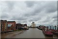
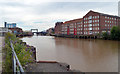
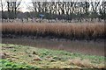
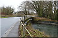
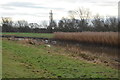
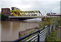
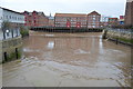
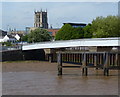
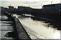
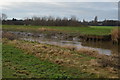
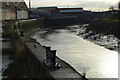
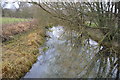
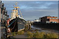
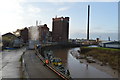
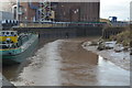
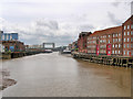
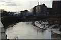
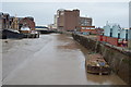
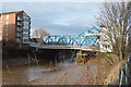
The River Hull is a navigable river in the East Riding of Yorkshire. It rises from a series of springs to the west of Driffield, and enters the Humber estuary at Kingston upon Hull.
Most of its course is through low lying land that is at or just above sea level, causing flooding to be a long-standing problem. Since 1980, the mouth of the river has been protected by a tidal barrier, which can be closed to prevent tidal surges entering the river system and causing flooding.
Wikipedia: Link
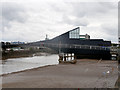
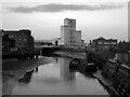
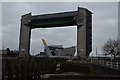
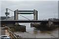
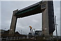
Most of the bridges which cross the river are movable, to allow shipping to pass. There are six swing bridges, four bascule bridges, two of which have twin leaves, one for each carriageway of the roads which they carry, and three Scherzer lift bridges, which are a type of rolling bascule bridge. Scott Street Bridge, which is now permanently raised, was originally powered from a high pressure water main maintained by the first public power distribution company in the world.
Most of its course is through low lying land that is at or just above sea level, causing flooding to be a long-standing problem. Since 1980, the mouth of the river has been protected by a tidal barrier, which can be closed to prevent tidal surges entering the river system and causing flooding.
Wikipedia: Link
Most of the bridges which cross the river are movable, to allow shipping to pass. There are six swing bridges, four bascule bridges, two of which have twin leaves, one for each carriageway of the roads which they carry, and three Scherzer lift bridges, which are a type of rolling bascule bridge. Scott Street Bridge, which is now permanently raised, was originally powered from a high pressure water main maintained by the first public power distribution company in the world.
by N Chadwick
Created: Thu, 30 Apr 2015, Updated: Thu, 18 May 2017
124 images use this description. Preview sample shown below:
... and 99 more images.
Shared descriptions
This shared description
The 'Shared Description' text on this page is © copyright 2015 N Chadwick.
Shared descriptions are specifically licensed so that contributors can reuse them on their own images, without restriction.
About shared descriptions
These Shared Descriptions are common to multiple images.
For example, you can create a generic description for an object shown in a photo, and reuse the description on all photos of the object. All descriptions are public and shared between contributors, i.e. you can reuse a description created by others, just as they can use yours.
Explore images
View images using this "River Hull" Shared Description
View images mentioning the words [River Hull] anywhere in text
Other shared descriptions
Related descriptions
- The Knock River, Belfast
By Albert Bridge. Used on 100 images
- Humber Estuary
By N Chadwick. Used on 310 images
- The Humber Bridge
By N Chadwick. Used on 12 images
- The Humber Bridge
By David Dixon. Used on 36 images
- Driffield
By N Chadwick. Used on 95 images
- Stamford Bridge
By David Dixon. Used on 25 images
- Hogsmill River
By N Chadwick. Used on 35 images
The above selections are automatic and approximate, it might not always select closely matching descriptions