Shared description
The ruins of Corlick
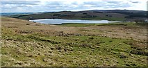
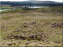
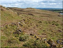
This farmstead, on the lower southern slopes of Corlic Hill (called Corlick Hill on the OS map), was already in ruins by the mid-nineteenth century. See Link (at Canmore) for further details, and Link for an annotated satellite view, on which the structures are clearly visible.
by Lairich Rig
Created: Thu, 13 May 2010, Updated: Thu, 16 Mar 2017
3 images use this description: (all images taken in 2010)
Shared descriptions
This shared description
The 'Shared Description' text on this page is © copyright 2010 Lairich Rig.
Shared descriptions are specifically licensed so that contributors can reuse them on their own images, without restriction.
About shared descriptions
These Shared Descriptions are common to multiple images.
For example, you can create a generic description for an object shown in a photo, and reuse the description on all photos of the object. All descriptions are public and shared between contributors, i.e. you can reuse a description created by others, just as they can use yours.
Explore images
Log in to view extended navigation and 'Explore' links.Other shared descriptions
Descriptions nearby
- Inverclyde Windfarm
- Hut circle
- Possible hut circles
- Hut circle
- Lithic working site
- Lurg Moor Roman fortlet
- War Department boundary stones, Whitelees
- Hut circle
- Loudenward field system
Related descriptions
- Inverclyde Windfarm
By Lairich Rig. Used on 2 images
- Hut circle
By Lairich Rig. Used on 3 images
- Lithic working site
By Lairich Rig. Used on 2 images
- Lurg Moor Roman fortlet
By Lairich Rig. Used on 5 images
- Whinhill Reservoir
By Lairich Rig. Used on 17 images
The above selections are automatic and approximate, it might not always select closely matching descriptions
