Shared description
River Mersey
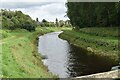
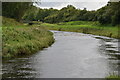
The River Mersey is in North West England. Its name is derived from the Anglo-Saxon and translates as "boundary river". The river may have been the border between the ancient kingdoms of Mercia and Northumbria and for centuries it formed part of the boundary between the historic counties of Lancashire and Cheshire.
The start of the Mersey is at the confluence of the River Tame and River Goyt in Stockport. It flows westwards through the suburban areas of south Manchester towards Warrington where the river widens before it then narrows as it passes between the towns of Runcorn and Widnes. From Runcorn the river widens into a large estuary, which is 3 miles (4.8 km) wide at its widest point near Ellesmere Port. The course of the river then heads north, with Liverpool to the east and the Wirral Peninsula to the west and finishes at Liverpool Bay. In total the river flows 70 miles.
The start of the Mersey is at the confluence of the River Tame and River Goyt in Stockport. It flows westwards through the suburban areas of south Manchester towards Warrington where the river widens before it then narrows as it passes between the towns of Runcorn and Widnes. From Runcorn the river widens into a large estuary, which is 3 miles (4.8 km) wide at its widest point near Ellesmere Port. The course of the river then heads north, with Liverpool to the east and the Wirral Peninsula to the west and finishes at Liverpool Bay. In total the river flows 70 miles.
by N Chadwick
Created: Fri, 13 May 2016, Updated: Fri, 13 May 2016
53 images use this description. Preview sample shown below:

2026

2025

2025

2025

2025

2025

2025

2025

2025

2024

2024

2024

2024

2024

2024

2023

2023

2023

2023
2020

2020
2020

2019

2016

1969
... and 28 more images.
Shared descriptions
This shared description
The 'Shared Description' text on this page is © copyright 2016 N Chadwick.
Shared descriptions are specifically licensed so that contributors can reuse them on their own images, without restriction.
About shared descriptions
These Shared Descriptions are common to multiple images.
For example, you can create a generic description for an object shown in a photo, and reuse the description on all photos of the object. All descriptions are public and shared between contributors, i.e. you can reuse a description created by others, just as they can use yours.
Explore images
Log in to view extended navigation and 'Explore' links.Other shared descriptions
Related descriptions
- River Axe (Somerset)
By N Chadwick. Used on 2 images
- The National Waterways Museum, Ellesmere Port
By David Dixon. Used on 67 images
- Manchester Ship Canal Railway at Ellesmere Port
By John Brightley. Used on 5 images
- West Stow Anglo-Saxon Village
By Rob Farrow. Used on 7 images
- Liverpool Airport
By N Chadwick. Used on 19 images
- Wirral and Mersey Special – 22 October 1966
By Alan Murray-Rust. Used on 13 images
- River Tame (Greater Manchester)
By Gerald England. Used on 185 images
The above selections are automatic and approximate, it might not always select closely matching descriptions
