Shared description
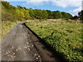
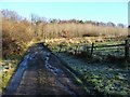
Footpath leading past Highdykes
One of West Dunbartonshire's core paths, about 1010 metres long, begins at c.NS40677859 (the end of a cul-de-sac in Broomhill Crescent), and follows a track that leads to and beyond Highdykes Farm, to end at c.NS41537905 (at a gate on a slope leading down to the Murroch Burn). At the time of writing (2016) this is Core Path 171 in the Core Paths Plan. The only obstacle noted for this route in the Core Paths list is a gate at the farm itself. See Link (at WDC) for current details.
by Lairich Rig
Created: Thu, 17 Nov 2016, Updated: Thu, 17 Nov 2016
17 images use this description:

2017

2017

2017

2016

2016

2016

2016

2016

2016

2016

2012
2012

2012

2012

2012

2012
2009
Shared descriptions
This shared description
The 'Shared Description' text on this page is © copyright 2016 Lairich Rig.
Shared descriptions are specifically licensed so that contributors can reuse them on their own images, without restriction.
About shared descriptions
These Shared Descriptions are common to multiple images.
For example, you can create a generic description for an object shown in a photo, and reuse the description on all photos of the object. All descriptions are public and shared between contributors, i.e. you can reuse a description created by others, just as they can use yours.
Explore images
Log in to view extended navigation and 'Explore' links.Other shared descriptions
Descriptions nearby
- The Gates of Sodom
- The Murroch Burn
- Bonhill High Dykes Development
- Remains of lime-kiln
- Lime-kiln ruins beside the Murroch Burn
- Lot's Wife
- Bomb craters near Auchenreoch decoy
- Remains of a lime-kiln or shieling hut
- Murroch lime-kiln ruin
- Mill Fields
- Auchenreoch Starfish decoy
- Remains of Auchenreoch Farm
- Alexandria ROC Bunker
- The remains of a track
- Disused quarry
- Dillichip Terrace
- Lime-kiln ruin
- Bonhill Quarry
- Enclosures beside the Spouts Burn
- Cornstone outcrops
- Remains of a longhouse
- The ruin of Spouts
- Strathleven House
- Cist on Auchenreoch Muir
Related descriptions
- River Leven (West Dunbartonshire)
By Lairich Rig. Used on 212 images
- The Murroch Burn
By Lairich Rig. Used on 52 images
- Murroch lime-kiln ruin
By Lairich Rig. Used on 3 images
- Lime-kiln ruins beside the Murroch Burn
By Lairich Rig. Used on 18 images
- Garshake Avenue to Whiteford Crescent
By Lairich Rig. Used on 4 images
- Remains of Auchenreoch Farm
By Lairich Rig. Used on 24 images
- Site of Hill of Garshake Farm
By Lairich Rig. Used on 3 images
The above selections are automatic and approximate, it might not always select closely matching descriptions
