Shared description
Wickham Market, Suffolk
Link
Wickham Market is a large village and electoral ward in the River Deben valley, Suffolk, England, within the Suffolk Coastal heritage area.
It is on the A12 trunk road 13 miles (21 km) north-east of the county town of Ipswich, 5 miles (8.0 km) north-east of Woodbridge. Its railway station is 2 miles (3.2 km) east at Campsea Ashe. The population at the 2011 Census was 2,156.
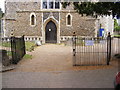
All Saints Church is over 700 years old and its octagonal tower and lead spire (137.5 feet tall) dominate the skyline and make it visible for miles over the surrounding countryside. The exterior of the church is stone and flintwork. Inside there are four stained glass windows, a 600-year-old font, a carved pulpit and an altar table with a painted reredos. There are six bells in the tower and a Sanctus Bell in the cote. Nearby attractions include: Valley Farm Equestrian Visitor Centre, Easton Farm Park, Glevering Hall, the Snape Maltings, Framlingham Castle and Sutton Hoo.
This extract uses material from the Wikipedia article "Wickham_Market", which is released under the Creative Commons Attribution-Share-Alike License 3.0.
by Geographer
Created: Tue, 19 Feb 2019, Updated: Tue, 19 Feb 2019
382 images use this description. Preview sample shown below:
... and 357 more images.
Shared descriptions
This shared description
The 'Shared Description' text on this page is © copyright 2019 Geographer.
Shared descriptions are specifically licensed so that contributors can reuse them on their own images, without restriction.
About shared descriptions
These Shared Descriptions are common to multiple images.
For example, you can create a generic description for an object shown in a photo, and reuse the description on all photos of the object. All descriptions are public and shared between contributors, i.e. you can reuse a description created by others, just as they can use yours.
Explore images
View images using this "Wickham Market, Suffolk" Shared Description
View images mentioning the words [Wickham Market, Suffolk] anywhere in text
Links for TM3055
This description is located in TM3055.

Other shared descriptions
Descriptions nearby
Related descriptions
- St Andrew's church, Bishopstone
By Julian P Guffogg. Used on 9 images
- Orford Castle - Suffolk
By Ashley Dace. Used on 84 images
- Church of Saint Mary, Berrow
By Bob Harvey. Used on 48 images
- St Lawrence's Church, Parsonage Lane, Hungerford
By Brian Robert Marshall. Used on 12 images
- All Saints' church, Holbeach
By Julian P Guffogg. Used on 17 images
- River Fynn
By N Chadwick. Used on 10 images
- Church of All Saints, Seagrave
By Alan Murray-Rust. Used on 14 images
The above selections are automatic and approximate, it might not always select closely matching descriptions
