Shared description
Flood Alleviation Schemes in Kingston upon Hull
In Kingston upon Hull, one of the biggest challenges faced is having enough space to store water during heavy or prolonged rainfall, and then moving water through and out of the city. Due to the low-lying nature of the city, water cannot naturally drain. It must be pumped out. Flood risk is managed in a variety of ways by the risk management authorities responsible. There are schemes all over the city acting to reduce the risk of flooding.
Aboveground Structures: The Tidal Surge Barrier reduces the risk of a tidal storm surge from coming up the River Hull from the Humber Estuary. Humber Hull Frontages - reducing the risk of a tidal storm surge from coming up the Humber Estuary. River Hull defences reduce the risk of fluvial or river flooding from the River Hull. These are potentially caused by increased flows coming from upstream.
Underground Structures: Culverts - moving water underground in pipes from one location to another. Gullies - taking water from highways and roads to reduce flood risk of surface water flooding.
Sewers and Pumping Stations: The sewers transport foul waste and surface water to east Hull wastewater treatment works. The pumping stations help the water move through the sewers. It is discharged into the Humber Estuary.
Sewers: Moving surface and wastewater underground to wastewater treatment works before being discharged into the Humber.
Bransholme Pumping Station: A surface water storage site and pumping station with the largest Archimedes screw pumps in Europe. It reduces the risk of sewer and surface water flooding in North Hull. This is done by delivering water from the storm sewer network to the River Hull.
East Hull Pumping Station: Four pumps installed to reduce the risk of fluvial or river flooding from the Holderness Drain. This is done by pumping water from the drain out into the Humber Estuary during high tide. Further information: Link
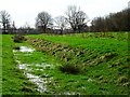
Nature-based Solutions: The Aquagreen Flood Alleviation Scheme is a nature-based solution to managing flood risk. This is done with Surface Water Storage areas. They fill during heavy or prolonged rainfall. This can reduce the risk of flooding as it slows the flow of surface water into the drainage system. Another benefit of this is that it also improves community green spaces. By giving space back to nature, more space is made for water.
Further reading:
Kingston upon Hull City Council: Link
Created: Thu, 2 Jan 2025, Updated: Thu, 2 Jan 2025
122 images use this description. Preview sample shown below:

2025

2025

2024

2024

2024

2024
2024

2024

2023

2022

2022

2020

2020

2020

2020

2019

2019

2017

2013

2013

2013

2012

2007

2007

2007
... and 97 more images.
Shared descriptions
This shared description
The 'Shared Description' text on this page is © copyright 2025 Bernard Sharp.
Shared descriptions are specifically licensed so that contributors can reuse them on their own images, without restriction.
About shared descriptions
These Shared Descriptions are common to multiple images.
For example, you can create a generic description for an object shown in a photo, and reuse the description on all photos of the object. All descriptions are public and shared between contributors, i.e. you can reuse a description created by others, just as they can use yours.
Explore images
Log in to view extended navigation and 'Explore' links.Other shared descriptions
Related descriptions
- Flood Alleviation Schemes: Aquagreens in Kingston upon Hull
By Bernard Sharp. Used on 50 images
- Flood Alleviation Scheme: River Hull Tidal Surge Barrier
By Bernard Sharp. Used on 39 images
- Flood Alleviation Scheme: Humber – Hull Frontages Flood Defence
By Bernard Sharp. Used on 20 images
- Flood Alleviation Scheme: Pumping Stations, Kingston upon Hull
By Bernard Sharp. Used on 3 images
- Holderness Drain, East Yorkshire
By Bernard Sharp. Used on 140 images
- River Hull Tidal Barrier
By N Chadwick. Used on 19 images
- River Hull
By N Chadwick. Used on 130 images
The above selections are automatic and approximate, it might not always select closely matching descriptions
