Shared description
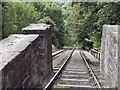
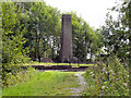
Hay Incline Plane
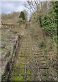
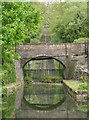
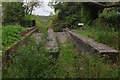
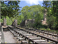
The Hay Incline Plane is a drop of 207 feet from the section of the Shropshire Canal at the top to Coalport at the bottom.
For more than 100 years, between the 1790s and 1980s, coal, iron and other products of the local industries were moved down to the Coalport Canal at the bottom of the incline to be taken, from there, onto the River Severn and transported to all parts of the country. Six of these canal inclines were built in this area between 1791 and 1797. The Hay Incline Plane is the only one which survives and is a Scheduled Ancient Monument.
The Incline generally worked by counterbalancing but, when no counterbalance weight was available, other power had to be used. In 1791, when the Incline was first in use, horses were used to power it. By 1793 a steam engine had been installed in a brick engine house the remains of which can be seen at the top of the Incline.
The last use of the incline is thought to have been in 1894.
by David Dixon
Created: Sun, 14 Aug 2011, Updated: Sun, 14 Aug 2011
11 images use this description:

2024

2023
2022
2018
2015

2013

2013
2011
2011
2011

1985
Shared descriptions
This shared description
The 'Shared Description' text on this page is © copyright 2011 David Dixon.
Shared descriptions are specifically licensed so that contributors can reuse them on their own images, without restriction.
About shared descriptions
These Shared Descriptions are common to multiple images.
For example, you can create a generic description for an object shown in a photo, and reuse the description on all photos of the object. All descriptions are public and shared between contributors, i.e. you can reuse a description created by others, just as they can use yours.
Explore images
Log in to view extended navigation and 'Explore' links.Other shared descriptions
Descriptions nearby
Related descriptions
- Blists Hill Victorian Town
By David Dixon. Used on 66 images
The above selections are automatic and approximate, it might not always select closely matching descriptions
