Shared description
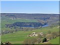
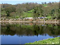
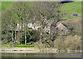
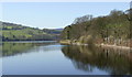
Damflask Reservoir
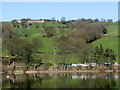
This is the largest and newest of the reservoirs in the Loxley River catchment area. It opened in 1897 for the Sheffield Corporation Waterworks; due to leakage problems it had been over 20 years in construction.
Unlike the higher reservoirs, Damflask was never intended for public water supply, instead being a compensation reservoir used to regulate water flow in the river for the benefit of the many industrial sites dependent on water power along the River Loxley. The two curving outlets at the foot of the dam are where the supply issues, controlled from the two pyramidal valve houses on the dam wall.
The dam itself is approximately 400 metres wide at the top, with a maximum height of 28 metres, and the reservoir has a capacity of nearly 5 million cubic metres of water. It now provides for sailing and fishing, and there is an easy-access circuit around the shore.
The name of the reservoir derives from the hamlet of Damflask. This was destroyed in the great flood of 1864 when the Dale Dyke Dam collapsed, and was never rebuilt because of the plans for the new Damflask Reservoir.
Created: Thu, 29 Mar 2012, Updated: Thu, 29 Mar 2012
18 images use this description:
2019

2012

2012

2012

2012

2012

2012

2012

2012

2012
2012

2012

2012

2012
2012

2012
2012
2012
Shared descriptions
This shared description
The 'Shared Description' text on this page is © copyright 2012 Alan Murray-Rust.
Shared descriptions are specifically licensed so that contributors can reuse them on their own images, without restriction.
About shared descriptions
These Shared Descriptions are common to multiple images.
For example, you can create a generic description for an object shown in a photo, and reuse the description on all photos of the object. All descriptions are public and shared between contributors, i.e. you can reuse a description created by others, just as they can use yours.
Explore images
Log in to view extended navigation and 'Explore' links.Other shared descriptions
Descriptions nearby
Related descriptions
- Loxley Valley Walk, Geograph Conference 2012
By Alan Murray-Rust. Used on 53 images
The above selections are automatic and approximate, it might not always select closely matching descriptions
