Showing most recent first, in descending order
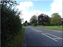
images in cluster A422 in SP6934
Image clustering - assigning images labels - is an automated process, based on the image title/description. It's not totally accurate, and can sometimes assign images to odd clusters
in SP6934, near Buckingham, taken Saturday, 28 September, 2019, by JThomas
Explore these images in the Browser or Explore matching images including in surrounding squares (if any!)
All images  © JThomas and licensed for reuse under this Creative Commons Licence
Other Automatic clusters in SP6934
- Old Gaol
- Museum
- Town of Buckingham
- Market Hill
- High Street
- Stowe Avenue
- Shop
- Market Square
- Ordnance Survey Cut Mark Benchmark Described
- West Street
- Post Office
- River Ouse
- Listed Buildings
- Masonic Hall
- Path
- Stratford Road
- Moreton Road
- Cornwalls Meadow
- Grand Junction
- Flea Market
- Flush Bracket 11028
- Gaoler's House
- Police Station
- Gatehouses on Stowe Avenue
- King's Head
- Postbox
- Christ's Hospital Almshouses
- Telephone Exchange
- Town Centre with New
- Chantry Chapel
- Brackley Road

