Showing most recent first, in descending order
images in cluster Area in NU1143
Image clustering - assigning images labels - is an automated process, based on the image title/description. It's not totally accurate, and can sometimes assign images to odd clusters
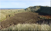
in NU1143, near Holy Island/NU1241, taken Friday, 27 October, 2017, by Russel Wills
Explore these images in the Browser or Explore matching images including in surrounding squares (if any!)
All images  © Russel Wills and licensed for reuse under this Creative Commons Licence
Other Automatic clusters in NU1143
- Lindisfarne Causeway
- Causeway Road
- Road beside the Dunes
- Sand Dunes
- North Shore
- Beach
- St Cuthbert's Way
- Village
- Shell Road
- Low Tide
- High Tide
- Holy Island Village
- Near
- Goswick Sands
- Coastal Scenery
- Parking Area
- Snook
- Eel Grass
- Pattern
- Sky
- Causeway is Clear
- Tidal Flats
- Castle
- Looking West
- Road Clings to the Southern Edge
- Heading for the Mainland
- Left and Saltmarsh on the Right
- Village NU1241 in the Distance