Showing most recent first, in descending order
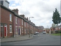
9 images in cluster Avenue in SE3133
Image clustering - assigning images labels - is an automated process, based on the image title/description. It's not totally accurate, and can sometimes assign images to odd clusters
in SE3133, near Leeds/SE3034
Explore these images in the Browser or Explore matching images including in surrounding squares (if any!)
Other Automatic clusters in SE3133
- Drive
- Pontefract Lane
- Marsh Lane
- Upper Accommodation Road
- East Park
- Torre Road
- York Road
- Cross
- Rider Street
- Saints Church
- East Park Drive
- Shannon Street
- Kippax Mount
- Richmond Hill
- Primary School
- Quarry House
- Lavender Walk
- Looking
- Dent Street
- Temple View
- Avenue
- Wesley Place
- Approach
- Kitson Street
- A64
- Flax Place
- Field
- Mills
- Nippet Lane
- Cross Catherine Street
- Ellerby Road
- Agnes Stewart School
- Rigton Approach
- Community Centre
- Railway Footbridge
- Public Footpath
- St Patrick's Church
- Electricity Substation
- Ordnance Survey Cut Mark Benchmark Described
- Remains of the Goods Yard
- Year Old former Council Flats
- Bridge HUL
- Tower Blocks
- Mount St Mary's Derelict Interior
- Torre Green
- Glensdale Grove
- Closed for Worship
- York Road Library
- Christ Temple of Worship
- Clay Pits that Served the Burmantofts Pottery
- Green Acres
- Area Meeting in former Industrial Buildings
- Architects Byron Clark Roberts
- Disused Church on Rider Street
- Haslewood Dene