Showing most recent first, in descending order

10 images in cluster Barnstaple Junction in SS5632

Image clustering - assigning images labels - is an automated process, based on the image title/description. It's not totally accurate, and can sometimes assign images to odd clusters

in SS5632, near Barnstaple


SS5632 : Riversvale Terrace at the junction of Taw Vale with Litchdon Street by Roger A Smith
Riversvale Terrace at the junction of Taw Vale with Litchdon Street
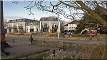
When: 17 January, 2024
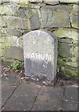
By: Roger A Smith
SS5632 : Newport Methodist Church by Neil Owen
Newport Methodist Church
When: 9 June, 2023
By: Neil Owen
SS5632 : Derelict Litchdon Street building, Barnstaple by Jaggery
Derelict Litchdon Street building, Barnstaple
When: 24 June, 2017
By: Jaggery
SS5632 : Western end of Salem Street, Barnstaple by Jaggery
Western end of Salem Street, Barnstaple
When: 24 June, 2017
By: Jaggery
SS5632 : The Rose and Crown public house - Now Mews apartments (South Street) by David Meredith
The Rose and Crown public house - Now Mews apartments (South Street)
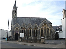
When: 13 January, 2017
By: David Meredith
SS5632 : The Rose and Crown public house - now Mews apartments (Newport Road) by David Meredith
The Rose and Crown public house - now Mews apartments (Newport Road)
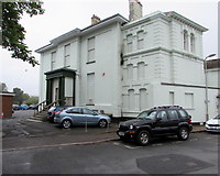
When: 2 January, 2017
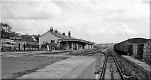
By: David Meredith
SS5632 : Ordnance Survey Cut Mark by Adrian Dust
Ordnance Survey Cut Mark
When: 4 July, 2016
By: Adrian Dust
SS5632 : Eastern Avenue, the route of the GWR line into Victoria Road Station by Roger A Smith
Eastern Avenue, the route of the GWR line into Victoria Road Station
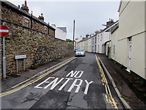
When: 18 August, 2014
By: Roger A Smith
SS5632 : Old Milestone, B3138 (Former A377), South Street, Barnstaple by Alan Rosevear
Old Milestone, B3138 (Former A377), South Street, Barnstaple
When: 8 February, 2013
By: Alan Rosevear
SS5632 : Barnstaple (Victoria Road) Station by Ben Brooksbank
Barnstaple (Victoria Road) Station
When: 17 April 1964
By: Ben Brooksbank

Explore these images in the Browser or Explore matching images including in surrounding squares (if any!)


Other Automatic clusters in SS5632

  1. Newport
  2. Road Barnstaple
  3. Trinity
  4. Coney Gut
  5. Newport Road
  6. Litchdon Street
  7. Rock Park
  8. River Taw
  9. Holy Trinity Church
  10. Penrose Almshouses
  11. Victoria
  12. Grade I Listed
  13. Ordnance Survey Cut Mark
  14. Trinity Street
  15. Gloster Road
  16. Barbican Terrace
  17. Station
  18. Coney Gut Passing
  19. Salem
  20. John
  21. Grosvenor Church
  22. Grade II Listed Building
  23. Newport Methodist Church
  24. Barnstaple Junction
  25. Tower
  26. South Street
  27. Benchmark
  28. Riversvale
  29. North Devon
  30. Memorial
  31. Eastern Avenue
  32. Cycle Path
  33. Seen from Upstream
  34. Church of St Mary
  35. Entrance
  36. Closer Look
  37. Near Town Walk
  38. Box
  39. Car Park
  40. Purpose were these Brick Paved Areas Created
  41. New Road
  42. Brannam's Pottery
  43. Long Bridge
  44. Blue Plaque
  45. Union Terrace
  46. Barum Court
  47. Corner Shop
  48. County Car Sales
  49. Medical Centre
  50. Eddy's Lane
  51. Portmarsh Field
  52. Outfall for the Storm Tunnel which Leads
  53. Goods Yard was still Open in 1969
  54. Great Western Railway
  55. Lamp Post on Taw
  56. Publishing House
You are not logged in login | register